World Heritage Identification Number: 711
World Heritage since: 1994
Category: Natural Heritage
WHE Type: Protected Areas & National Parks
Transboundary Heritage: No
Endangered Heritage: No
Country: 🇨🇴 Colombia
Continent: Americas
UNESCO World Region: Latin America and the Caribbean
Map
Los Katíos National Park: A Biodiversity Haven in Northwest Colombia
Los Katíos National Park, officially known as Parque Nacional Natural Los Katíos, is a significant protected area located in the northwest region of Colombia. Established in 1980 and inscribed as a UNESCO World Heritage Site in 1994, this pristine wilderness spans approximately 72,000 hectares (178,000 acres), making it one of the largest national parks in the country. The park's geographical location places it within the Darién Gap, a dense forested area shared by Colombia and Panama, and it is adjacent to the Darién National Park in Panama.
More to come…UNESCO Description of the World Heritage Site
Extending over 72,000 ha in north-western Colombia, Los Katios National Park comprises low hills, forests and humid plains. An exceptional biological diversity is found in the park, which is home to many threatened animal species, as well as many endemic plants.
UNESCO Justification of the World Heritage Site
Criterion (ix): Los Katíos played a major role in the biogeographical history of the Americas, a role which continues today. Its geographic location in northern Colombia made it a filter or barrier to the interchange of fauna between the Americas during the Tertiary. It is thought to be the site of a Pleistocene refuge, a hypothesis supported by the high proportion of endemic plants.
Criterion (x): The park is home to around 450 species of birds, some 25% and 50% respectively of the avifaunas of Colombia and Panama. Los Katíos is unique in South America for the large number of typically Central American species found in the park. It is the only protected area in this region of Colombia and is therefore the last refuge for many species which would otherwise become extinct. The park is also home to several threatened species. Around 20% of plant species occurring in the park are endemic to the Chocó-Darien region.
Encyclopedia Record: Los Katíos National Park
Los Katíos National Natural Park is a protected area located in northwest Colombia which covers about 720 km2 (280 sq mi). The elevation ranges between 50 and 600 m. It is a part of the Darién Gap, a densely forested area shared by Panama and Colombia, and is contiguous with the Darién National Park in Panama. The Pan-American Highway, when completed as proposed, would pass near or through Los Katíos. The park was declared a UNESCO World Heritage Site in 1994 due to the extraordinary diversity of plant and animal species represented.Additional Site Details
Area: 72,000 hectares
Number of Components: 1
(x) — Contains most important habitats for biodiversity
Coordinates: 7.803975 , -77.146271
IUCN World Heritage Outlook
The 2025 Conservation Outlook on Los Katios National Park reports the following assessment:
Source: International Union for Conservation of Nature (IUCN) · View assessment
Image
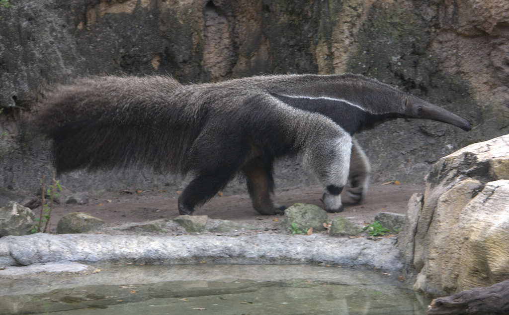
© LaggedOnUser, CC BY-SA 2.0 Resized from original. (This derivative is under the same CC BY-SA license.)
World Heritage Research
Discover scientific research and academic studies that deepen our understanding of Los Katíos National Park from its history and significance to its conservation, management, and contemporary challenges.
-
Evaluación de impacto en áreas de conservación: retos y una herramienta para aplicar análisis contrafactuales
A robust analysis of 23 Colombian national parks reveals that protected areas significantly reduce deforestation, with effectiveness varying between -54% and 100%, though most show positive impacts (average 73.6%). The study introduces CONTRAFACTUAL, a counterfactual tool using propensity score matching to compare treated units (protected areas) against similar control regions. This methodology provides a rigorous framework for evaluating conservation strategies, addressing gaps in impact assessment and offering actionable insights for policymakers, managers, and stakeholders. By contextualizing deforestation metrics, the research demonstrates how contrafactual analysis can enhance adaptive learning and resource allocation in conservation efforts.
Forero-Medina, G., J. Arroyave, F., Rincón-Parra, V. J., Álvarez, S. J., & Negret, P. J. (2026). Impact evaluation in area-based conservation: challenges and an app for conducting counterfactuals in Colombia. Revista de La Academia Colombiana de Ciencias Exactas, Físicas Y Naturales. https://doi.org/10.18257/raccefyn.4027
View Publication Record | Read Publication -
Una propuesta de análisis espacial para definir la dificultad de sustitución de la coca en parques nacionales naturales de Colombia
A multivariate spatial analysis model has been developed to assess the difficulty of replacing coca cultivation within Colombia's National Natural Parks, including Los Katíos National Park. This approach identifies key variables influencing coca production and trafficking, offering critical insights for policy refocusing beyond traditional prohibitionist strategies. The study highlights the convergence between drug trafficking and environmental protection challenges, providing a data-driven framework to guide more effective interventions in strategic natural areas.
Garre Pelegrina, S., & Ramírez Rincón, B. Y. (2023). A spatial analysis proposal to define the difficulty of replacing coca in National Natural Parks of Colombia. Análisis Jurídico - Político, 5(10), 65–120. https://doi.org/10.22490/26655489.6852
View Publication Record | Read Publication -
Horizon du patrimoine mondial de l’UICN 3 : une évaluation de la conservation de tous les sites du patrimoine mondial naturel
A global assessment of the conservation status of UNESCO World Heritage Sites reveals concerning trends, with only 30% meeting or exceeding the highest conservation standards. The study, based on three cycles of evaluations since 2014, highlights significant threats to natural values in these sites and questions their effectiveness as a tool for biodiversity protection. Los Katíos National Park, recognized for its unique ecosystems, is among those facing persistent challenges despite international recognition. This analysis serves as a critical indicator for measuring progress toward global biodiversity goals post-2020.
Osipova, E., Emslie-Smith, M., Osti, M., Murai, M., Aberg, U., & Shadie, P. (2022). Horizon du patrimoine mondial de l’UICN 3 : une évaluation de la conservation de tous les sites du patrimoine mondial naturel. https://doi.org/10.2305/iucn.ch.2020.16.fr
View Publication Record | Read Publication -
Lineamientos de planificación para la integración transfronteriza de áreas protegidas a partir de la priorización de sus valores naturales. Caso de estudio: región natural colombo-venezolana Macizo del Tama
A transboundary conservation strategy for Los Katíos National Park (Colombia) and Tamá National Park (Venezuela), part of the Macizo del Tama region, highlights the critical role of cross-border ecological connectivity in preserving Andean ecosystems. The study identifies key natural values that should guide integrated planning to enhance biodiversity protection. It employs a prioritization framework to assess ecological systems spanning both parks, addressing challenges posed by national borders while emphasizing their strategic location for conservation efforts.
Montes Casadiego, M. X. Lineamientos de planificación para la integración transfronteriza de áreas protegidas a partir de la priorización de sus valores naturales. Caso de estudio: región natural colombo-venezolana Macizo del Tama. https://doi.org/10.11144/javeriana.10554.62831
View Publication Record | Read Publication