World Heritage Identification Number: 1207
World Heritage since: 2006
Category: Cultural Heritage
WHE Type: Cultural Landscapes
Transboundary Heritage: No
Endangered Heritage: No
Country: 🇴🇲 Oman
Continent: Asia
UNESCO World Region: Arab States
Map
Ancient Water Management: The Aflaj Irrigation Systems of Oman
The Aflaj Irrigation Systems of Oman, inscribed as a UNESCO World Heritage Site in 2006, showcase an ingenious and sustainable approach to water management that has been in use since at least AD 500. These systems are found in the regions of Dakhiliyah, Sharqiyah, and Batinah, although their roots may extend back even further, with archaeological evidence suggesting irrigation systems existed in this arid region as early as 2500 BC.
More to come…UNESCO Description of the World Heritage Site
The property includes five aflaj irrigation systems and is representative of some 3,000 such systems still in use in Oman. The origins of this system of irrigation may date back to AD 500, but archaeological evidence suggests that irrigation systems existed in this extremely arid area as early as 2500 BC. Using gravity, water is channelled from underground sources or springs to support agriculture and domestic use. The fair and effective management and sharing of water in villages and towns is still underpinned by mutual dependence and communal values and guided by astronomical observations. Numerous watchtowers built to defend the water systems form part of the site reflecting the historic dependence of communities on the aflaj system. Threatened by falling level of the underground water table, the aflaj represent an exceptionally well-preserved form of land use.
UNESCO Justification of the World Heritage Site
Criterion (v): The collection of Aflaj irrigation systems represents some 3,000 still functioning systems in Oman. Ancient engineering technologies demonstrate long standing, sustainable use of water resources for the cultivation of palms and other produce in extremely arid desert lands. Such systems reflect the former total dependence of communities on this irrigation and a time-honoured, fair and effective management and sharing of water resources, underpinned by mutual dependence and communal values.
Encyclopedia Record: Aflaj Irrigation Systems of Oman
The Aflaj Irrigation Systems of Oman are ancient water harvesting, transportation, storage and distribution systems from AD 500 located in the Omani regions of Dakhiliyah, Sharqiyah and Batinah. They do however represent a type of irrigation system with a history going back 5,000 years in the Middle East, one type being known from Persia under the name qanat or kariz. Aflaj systems may include an underground horizontal section accessed by vertical shafts, which collects water from the aquifer by using the same technology as the Iranian qanat systems, and always include surface channels for transport and distributiin.Additional Site Details
Area: 1,455.949 hectares
Number of Components: 5
Coordinates: 22.9988888889 , 57.5360555555
Image
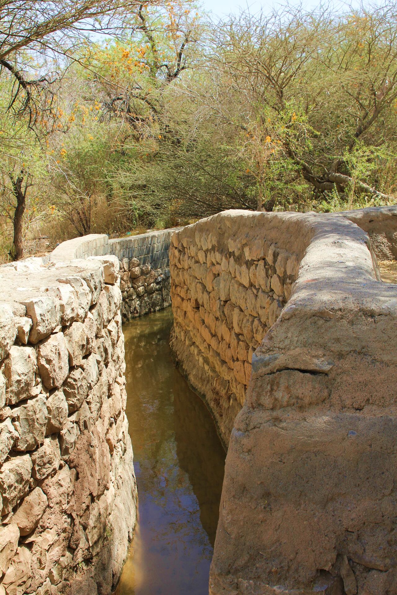
© Paolotacchi, CC BY-SA 3.0 Resized from original. (This derivative is under the same CC BY-SA license.)
World Heritage Research
Discover scientific research and academic studies that deepen our understanding of Aflaj Irrigation Systems of Oman from its history and significance to its conservation, management, and contemporary challenges.
-
Geological and Geotechnical Studies Aimed at the Project and Construction of Rockfill Recharge Dams: The Case Study of the Wadi Sulayf Dam, Wilayat Ibri Region, Oman
A novel approach to sustainable water management in Oman's semi-desert region has been successfully demonstrated through the construction of rockfill recharge dams, which utilize temporary floodwaters to augment the Aflaj irrigation system. The Wadi Sulayf Dam, a 3200-meter structure near Ibri Town, serves as a case study showcasing the integration of geological and geotechnical design principles with practical implementation. Despite encountering significant flooding during construction—an event that typically causes structural damage—the dam remained intact, highlighting its robust engineering. This project not only addresses growing water demand for drinking and agriculture but also provides a model for resilient infrastructure development in arid environments.
Canzoneri, V., Bonfardeci, A., Bongiovanni, S., Coletta, L., Curcuruto, E. P., Gasparo Morticelli, M., Sulli, A., & Canzoneri, A. (2025). Geological and Geotechnical Studies Aimed at the Project and Construction of Rockfill Recharge Dams: The Case Study of the Wadi Sulayf Dam, Wilayat Ibri Region, Oman. Geotechnics, 5(4), 74. https://doi.org/10.3390/geotechnics5040074
View Publication Record | Read Publication -
Hydrological impacts of recharge dams on Aflaj systems in Oman: A long-term analysis
Recharge dams significantly enhance the sustainability of traditional Aflaj irrigation systems, increasing annual discharge volumes by 65% and improving flow stability by 25%, even during low rainfall events. This long-term analysis, spanning 24 years in Oman's North Sharqiyah Governorate, compared two catchments—one with a recharge dam and one without—to assess hydrological impacts. Findings reveal that dams mitigate groundwater depletion trends, stabilize discharge flows, and buffer climate-induced fluctuations, providing quantitative evidence for integrating modern infrastructure with ancient water management practices to ensure long-term resilience in arid regions.
Al-Aamri, S., Kantoush, S. A., Kobayashi, S., Saber, M., Nguyen, B. Q., Al Mamari, M. M., & Emara, A. (2026). Hydrological impacts of recharge dams on Aflaj systems in Oman: A long-term analysis. Results in Engineering, 29, 108691. https://doi.org/10.1016/j.rineng.2025.108691
View Publication Record | Read Publication -
Re-instating the Indigenous Ecology of Oman's Aflaj in Zahran Al Qasimi's Taghribat Al-Qafer or The Exile of the Water Diviner
Zahran Al Qasimi's novel Taghribat Al-Qafer or The Exile of the Water Diviner (2022) challenges global hegemonic narratives on environmental sustainability by reaffirming the Indigenous ecological knowledge embedded in Oman’s aflaj irrigation systems. Through a syncretic narrative blending tribal history with contemporary themes, the work exposes and preserves the social and environmental dimensions of aflaj practices, which have sustained Omani communities for centuries. The study argues that Al Qasimi’s narrative transcends functional sustainability, instead framing aflaj as a cornerstone of Omani identity, relational epistemologies, and posthuman ecologies rooted in interconnectedness, resilience ('survivance'), and regenerative hope. By mobilizing Indigenous environmental advocacy, the novel counters epistemic monopolization while weaving local cosmologies and ethics into a broader framework of place-based sustainability.
Atieh, M. (2025). Re-instating the Indigenous Ecology of Oman’s Aflaj in Zahran Al Qasimi’s Taghribat Al-Qafer or The Exile of the Water Diviner. Environment, Space, Place, 17(2), 145–166. https://doi.org/10.1353/spc.2025.a1000505
View Publication Record | Read Publication -
Assessing the Impact of Land Use and Land Cover Changes on Aflaj Systems over a 36-Year Period
Over the past 36 years, Oman's aflaj irrigation systems—ancient underground water networks—have faced significant land use and land cover (LULC) changes, primarily driven by urban expansion. A study analyzing four major aflaj in northern Oman found that between 1985 and 2021, agricultural lands were converted to urban areas at rates of up to 40%, leading to a decline in vegetation cover and groundwater resources. Using satellite imagery, GIS, and remote sensing, researchers classified LULC changes with high accuracy (90–95%), revealing shifts from bare soil to urban areas and from vegetation to bare soil. These findings underscore the need for sustainable land management strategies to preserve aflaj systems, which are critical for water security in arid regions.
Al-Kindi, K. M., Alqurashi, A. F., Al-Ghafri, A., & Power, D. (2023). Assessing the Impact of Land Use and Land Cover Changes on Aflaj Systems over a 36-Year Period. Remote Sensing, 15(7), 1787. https://doi.org/10.3390/rs15071787
View Publication Record | Read Publication -
Machine Learning and Hyperparameters Algorithms for Identifying Groundwater Aflaj Potential Mapping in Semi-Arid Ecosystems Using LiDAR, Sentinel-2, GIS Data, and Analysis
Research identifies Bayesian optimization as the most efficient hyperparameter algorithm for predicting groundwater aflaj potential in semi-arid ecosystems, achieving 99% accuracy. The study, conducted in Nizwa, Oman, used machine learning models (SVM and XGB) combined with Sentinel-2, LiDAR, and GIS data to map potential zones into five classes: deficient, low, moderate, high, and very high. Bayesian-XGB outperformed other models (GS-XGB, RS-XGB, SVM) in validation, highlighting its superior efficiency for groundwater aflaj mapping. The findings emphasize the importance of integrating geospatial and machine learning techniques to support integrated water source management (IWSM) programs and protect historical aflaj irrigation systems from threats.
Al-Kindi, K. M., & Janizadeh, S. (2022). Machine Learning and Hyperparameters Algorithms for Identifying Groundwater Aflaj Potential Mapping in Semi-Arid Ecosystems Using LiDAR, Sentinel-2, GIS Data, and Analysis. Remote Sensing, 14(21), 5425. https://doi.org/10.3390/rs14215425
View Publication Record | Read Publication -
Production and the Exploitation of Resources
Aflaj irrigation systems in Oman represent a sophisticated pre-modern hydraulic technology that sustained agricultural productivity and pastoral economies for centuries. This volume synthesizes archaeological, historical, and ethnographic evidence to demonstrate how Aflaj—gravity-fed underground channels—integrated with broader patterns of resource exploitation across the Islamic world. It reveals their origins in Sassanian water-management traditions, their adaptation under early Islam, and their role in fostering agricultural innovation, including the introduction of new crops like rice. Through case studies from Oman, Iran, Syria, and al-Andalus, the research highlights the Aflaj's dual function: as a tool for sustainable land use and a symbol of imperial and religious authority. Methodologically, it combines textual analysis (e.g., agricultural treatises by al-Hamdani or Al-Falaha) with archaeological surveys (e.g., mining sites in Oman’s southwestern province), offering a multidisciplinary framework to trace the diffusion and impact of Islamic hydraulic technology.
Morony, M. G. (2022). Production and the Exploitation of Resources (, Ed.). Routledge. https://doi.org/10.4324/9781315245973
View Publication Record | Read Publication -
Assessment of Falaj Water Quality
Aflaj irrigation systems, vital to Oman's water supply with 92% used for irrigation and the rest for domestic purposes, face significant contamination risks due to continuous human interventions. A study assessing water quality in Samail, Oman, found that biological contaminants pose substantial health hazards, necessitating proper disinfection measures. The research evaluated physical, chemical, and biological parameters, revealing alarming levels of contamination that could lead to adverse health effects if left unaddressed.
Shaik, F., S. AL-Siyabi, Said., Rao Lakkimsetty, N., Ali Syed, M., & ohammed, N. M. (2021). Assessment of Falaj Water Quality. Asian Journal of Water, Environment and Pollution, 18(1), 25. https://doi.org/10.3233/ajw210004
View Publication Record | Read Publication