World Heritage Identification Number: 739
World Heritage since: 1995
Category: Cultural Heritage
WHE Type: Cultural Landscapes
Transboundary Heritage: No
Endangered Heritage: No
Country: 🇳🇱 Netherlands (Kingdom of the)
Continent: Europe
UNESCO World Region: Europe and North America
Map
The Island of Schokland: A Testament to Human Resilience Against the Sea
The Island of Schokland, located within the municipality of Noordoostpolder in the Netherlands, stands as a remarkable testament to human resilience and adaptability in the face of nature's relentless forces. Inscribed as a UNESCO World Heritage Site in 1995, Schokland offers a unique glimpse into the age-old struggle between humans and the sea, a battle that has defined the Dutch landscape for centuries.
More to come…UNESCO Description of the World Heritage Site
Schokland was a peninsula that by the 15th century had become an island. Occupied and then abandoned as the sea encroached, it had to be evacuated in 1859. But following the draining of the Zuider Zee, it has, since the 1940s, formed part of the land reclaimed from the sea. Schokland has vestiges of human habitation going back to prehistoric times. It symbolizes the heroic, age-old struggle of the people of the Netherlands against the encroachment of the waters.
UNESCO Justification of the World Heritage Site
Criterion (iii): Schokland and its surroundings preserve the last surviving evidence of a prehistoric and early historic society that had adapted to the precarious life of wetland settlements under the constant threat of temporary or permanent incursions by the sea.
Criterion (v): Schokland is included in the agricultural landscape that was created as a result of the reclamation of the former Zuider Zee, part of the never-ceasing struggle of the people of the Netherlands against the water and one of the greatest and most visionary human achievements of the twentieth century. The history of this region is excellently represented in this small area, with its settlements, cemeteries, terps, dykes and parcel systems.
Encyclopedia Record: Schokland
Schokland is a former island in the Dutch Zuiderzee, in the municipality of Noordoostpolder. Schokland was an elongated strip of peat land which ceased to be an island when the Noordoostpolder was reclaimed from the sea in 1942. It is now just a slightly elevated part of the polder, with a still partly intact retaining wall of the waterfront of Middelbuurt. On 1 April 2014, it had 8 inhabitants, but according to Statistics Netherlands there are five people living on the former island.Additional Site Details
Area: 1,306 hectares
Number of Components: 1
(v) — Outstanding example of traditional human settlement
Coordinates: 52.63861111 , 5.771666667
Image
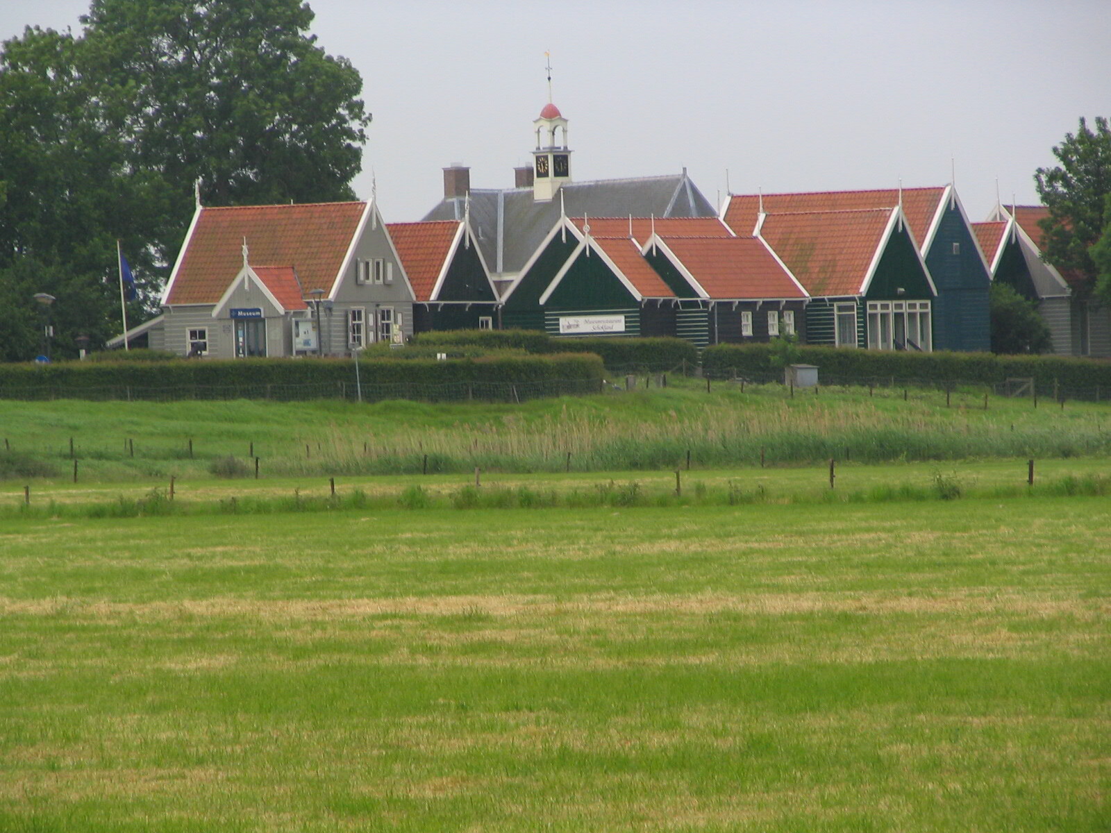
© GerardM, CC BY-SA 3.0 Resized from original. (This derivative is under the same CC BY-SA license.)
World Heritage Research
Discover scientific research and academic studies that deepen our understanding of Schokland and Surroundings from its history and significance to its conservation, management, and contemporary challenges.
-
Unveiling Climate-Adaptive World Heritage Management Strategies: The Netherlands as a Case Study
Research identifies two climate-adaptive World Heritage management strategies (CAWHMSs) that integrate conservation and collaborative knowledge-sharing, using Dutch UNESCO sites as a case study. These strategies—conservation for urban climate regulation and sustainable water management, and developing WH properties as multidisciplinary hubs—enhance resilience to climate threats while fostering awareness among younger generations. The study analyzed textual data from Statements of Outstanding Universal Value, State of Conservation Reports, and management plans, employing qualitative coding and semantic networks to visualize findings. Results underscore the role of World Heritage in advancing holistic climate adaptation efforts, offering a model for cross-sectoral stakeholders globally.
Cheang, K., Bai, N., & Pereira Roders, A. (2025). Unveiling Climate-Adaptive World Heritage Management Strategies: The Netherlands as a Case Study. Sustainability, 17(12), 5555. https://doi.org/10.3390/su17125555
View Publication Record | Read Publication -
A different view on (world) heritage. The need for multi-perspective data analyses in historical landscape studies: The example of Schokland (NL)
A novel Historical Geographical Information System (HGIS) demonstrates the potential to significantly enhance the contextualization, accessibility, and conservation of UNESCO World Heritage Sites like Schokland. This system integrates cultural and geoscientific data, enabling dynamic heritage management that supports multidisciplinary scientific analyses, integrated monitoring, and public outreach. The findings highlight the necessity for tailored conservation methodologies that rely on comprehensive data integration, offering valuable insights into diachronological reconstructions of landscape development in lowlands. Such an approach not only meets modern standards for heritage conservation but also addresses the diverse needs of multiple stakeholders, including governmental, scientific, public, and commercial entities.
van Lanen, R. J., van Beek, R., & Kosian, M. C. (2022). A different view on (world) heritage. The need for multi-perspective data analyses in historical landscape studies: The example of Schokland (NL). Journal of Cultural Heritage, 53, 190–205. https://doi.org/10.1016/j.culher.2021.11.011
View Publication Record | Read Publication -
The use of geological, geomorphological and soil mapping products in palaeolandscape reconstructions for the Netherlands
A comprehensive integration of geological, geomorphological, and soil mapping products can significantly enhance palaeolandscape reconstructions for the Netherlands. This study evaluates how diverse legacy datasets—compiled over centuries by various disciplines—can be effectively combined using modern digital tools like GIS to generate accurate palaeogeographical maps. It highlights the importance of understanding historical surveying strategies and the context in which original data were collected to maximize the potential of these datasets. By addressing challenges posed by fragmented, regionally varied data, this approach offers a robust method for answering both applied and fundamental scientific questions, particularly in areas with extensive historical mapping traditions.
Pierik, H. J., & Cohen, K. M. (2020). The use of geological, geomorphological and soil mapping products in palaeolandscape reconstructions for the Netherlands. Netherlands Journal of Geosciences, 99. https://doi.org/10.1017/njg.2020.8
View Publication Record | Read Publication -
When the Shore becomes the Sea: New maritime archaeological insights on the dynamic development of the northeastern Zuyder Zee region (AD 1100 – 1400), the Netherlands
Between 1100 and 1400 AD, the northeastern Zuyder Zee region underwent dramatic transformation from uninhabited peatlands to open sea, erasing nearly all traces of human activity. This rapid shift was driven by a combination of natural storm surges and human land reclamation practices that destabilized the landscape. The study, integrating archaeological, geological, and historical-geographic data in a digital spatial environment, reveals that late medieval settlements—evidenced by pottery, bricks, and animal bones—were among the last remnants of this dynamic region where communities adapted to water-driven changes. These findings highlight the dual impact of environmental forces: while storms destroyed land and livelihoods, they also opened new maritime trade routes that later brought prosperity.
van Popta, Y. When the Shore becomes the Sea: New maritime archaeological insights on the dynamic development of the northeastern Zuyder Zee region (AD 1100 – 1400), the Netherlands. https://doi.org/10.33612/diss.135931299
View Publication Record | Read Publication -
The Never-Ending Story? The Lessons of Fifteen Years of Archaeological Monitoring at the Former Island of Schokland
Archaeological monitoring over fifteen years at Schokland, now part of the Netherlands' mainland after drainage in the 1940s, has revealed a dynamic landscape shaped by human settlement and environmental change. The study highlights the significance of Mesolithic campsites, Neolithic and Bronze Age settlements, and medieval dwelling mounds (terps) within this UNESCO World Heritage Site. By analyzing these layers, researchers uncovered how past communities adapted to shifting environments, including rising water levels that necessitated the construction of terps for habitation. The approach combined extensive field surveys, stratigraphic analysis, and interdisciplinary research to reconstruct Schokland's complex history, offering insights into human resilience and environmental interaction in a rapidly changing landscape.
Huisman, D. J., & Mauro, G. (2012). The Never-Ending Story? The Lessons of Fifteen Years of Archaeological Monitoring at the Former Island of Schokland. Conservation and Management of Archaeological Sites, 14(1-4), 406–428. https://doi.org/10.1179/1350503312z.00000000036
View Publication Record | Read Publication