
World Heritage Identification Number: 1276
World Heritage since: 2008
Category: Cultural Heritage
WHE Type: Infrastructure & Industry
Transboundary Heritage: Yes
Endangered Heritage: No
Country: Italy, Switzerland
Continent: Europe
UNESCO World Region: Europe and North America
Map
The Rhaetian Railway in the Albula / Bernina Landscapes: A Technological Marvel in the Swiss Alps
The Rhaetian Railway in the Albula / Bernina Landscapes, inscribed as a UNESCO World Heritage Site in 2008, showcases an extraordinary feat of engineering and a testament to human ingenuity in overcoming the formidable challenges posed by the Swiss Alps. This railway system, operated by the Rhaetian Railway (RhB), connects remote settlements in the Central Alps, significantly impacting the socio-economic development of these regions.
More to come…UNESCO Description of the World Heritage Site
Rhaetian Railway in the Albula / Bernina Landscapes, brings together two historic railway lines that cross the Swiss Alps through two passes. Opened in 1904, the Albula line in the north western part of the property is 67 km long. It features an impressive set of structures including 42 tunnels and covered galleries and 144 viaducts and bridges. The 61 km Bernina pass line features 13 tunnels and galleries and 52 viaducts and bridges. The property is exemplary of the use of the railway to overcome the isolation of settlements in the Central Alps early in the 20th century, with a major and lasting socio-economic impact on life in the mountains. It constitutes an outstanding technical, architectural and environmental ensemble and embodies architectural and civil engineering achievements, in harmony with the landscapes through which they pass.
UNESCO Justification of the World Heritage Site
Criterion (ii): The Rhaetian Railway of Albula/Bernina constitutes an outstanding technical, architectural and environmental ensemble. The two lines, today unified in a single transalpine line, embody a very comprehensive and diversified set of innovative solutions that bear witness to substantial interchanges of human and cultural values in the development of mountain railway technologies, in terms of its architectural and civil engineering achievements, and its aesthetic harmony with the landscapes through which they pass.
Criterion (iv): The Rhaetian Railway of Albula/Bernina is a very significant illustration of the development of mountain railways at high altitudes in the first decade of the 20th century. It represents a consummate example of great quality, which was instrumental in the long-term development of human activities in the mountains. It offers diversified landscapes in conjunction with the railway that are significant of this period of the flourishing of a relationship between man and nature.
Encyclopedia Record: Rhaetian Railway
The Rhaetian Railway, abbreviated RhB, is a Swiss transport company that owns the largest network of all private railway operators in Switzerland. Headquartered in Chur, the RhB operates all the railway lines of the Swiss canton of Grisons, except for the line from Sargans to the cantonal capital, Chur, which is operated by Swiss Federal Railways (SBB CFF FFS), as well as the line from Disentis/Mustér to the Oberalp Pass and further on to Andermatt, Uri, which is operated by Matterhorn Gotthard Bahn (MGB). Inaugurated in 1888 and expanded from 1896 onwards in various sections, the RhB network is located almost entirely within Grisons, with one station across the Italian border at Tirano.Additional Site Details
Area: 152.42 hectares
Number of Components: 1
(iv) — Outstanding example of a type of building or landscape
Coordinates: 46.4983333333 , 9.8463888889
Image
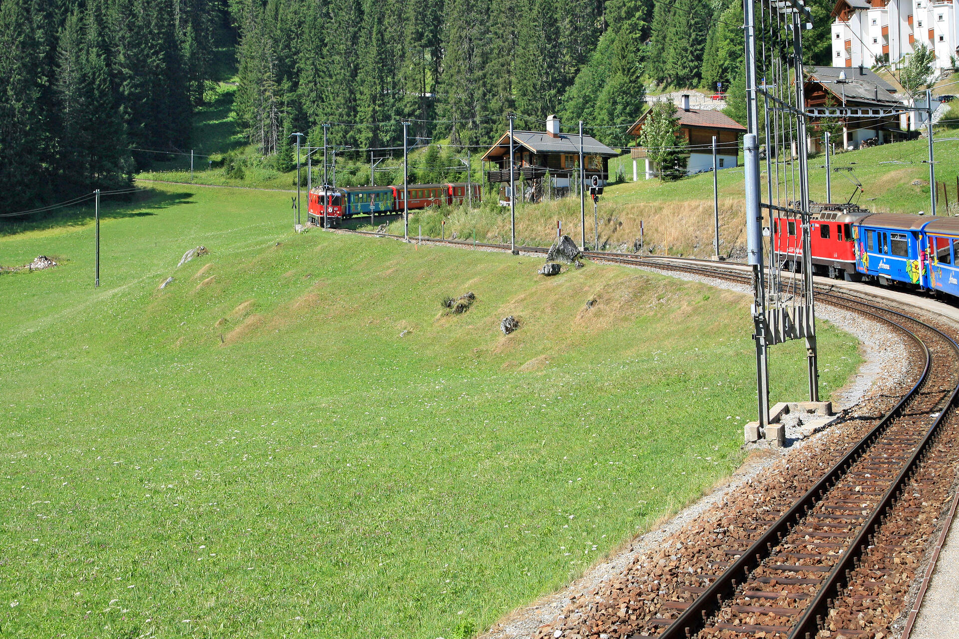
© W. Bulach, CC BY-SA 4.0 Resized from original. (This derivative is under the same CC BY-SA license.)
World Heritage Research
Discover scientific research and academic studies that deepen our understanding of Rhaetian Railway in the Albula / Bernina Landscapes from its history and significance to its conservation, management, and contemporary challenges.
-
Shaping territorial agri-food systems through social innovations: The example of Valposchiavo, Switzerland
Valposchiavo, Switzerland, exemplifies how territorial agri-food systems can emerge as social innovations that challenge conventional corporate food governance. This study highlights the development of a 100% Valposchiavo approach, characterized by diverse local collaborations and a strong emphasis on organic agriculture, as a novel multi-actor setting within its territorial agri-food system. The research identifies an innovative governance strategy aimed at achieving certification as an organic region, signaling a proactive shift toward sustainability. To uncover these insights, the study employed a territorial social innovation framework, combining existing interviews with problem-centered fieldwork. This approach underscores the potential of social innovations to revalorize local resources and shape sustainable territorial development.
Froning, P., & Stotten, R. (2024). Shaping territorial agri-food systems through social innovations: The example of Valposchiavo, Switzerland. Rivista Di Economia Agraria, 79(1), 33–46. https://doi.org/10.36253/rea-14833
View Publication Record | Read Publication -
Territorial rural development strategies based on organic agriculture: the example of Valposchiavo, Switzerland
Remote mountain valleys can successfully counteract the disembedding effects of globalization through territorial rural development strategies rooted in organic agriculture. A case study of Valposchiavo, Switzerland, reveals that such approaches—centered on neo-endogenous development—strengthen local agro-food systems by fostering internal and external networks, establishing a territorial brand, and creating regional supply chains. This model enhances community well-being while mitigating globalization's negative impacts. The research employed document analysis, secondary interviews, and problem-centered interviews to explore these dynamics, offering a blueprint for sustainable rural development in marginalized regions.
Stotten, R., & Froning, P. (2023). Territorial rural development strategies based on organic agriculture: the example of Valposchiavo, Switzerland. Frontiers in Sustainable Food Systems, 7. https://doi.org/10.3389/fsufs.2023.1182993
View Publication Record | Read Publication -
Automated avalanche hazard indication mapping on a statewide scale
An automated approach to avalanche hazard indication mapping has been successfully developed and applied statewide, addressing a significant gap in hazard assessment for the Canton of Grisons, Switzerland. This method combines digital elevation modeling with numerical simulations of avalanche dynamics, accounting for forest protective effects across eight scenarios with varying return periods. Validated against official maps, expert assessments, and satellite-derived cadastres, this innovative technique enables reproducible hazard indication mapping in regions lacking historical records, offering invaluable insights for climate change studies. The approach is now operationally used by authorities and can be replicated globally where high-resolution data are available.
Bühler, Y., Bebi, P., Christen, M., Margreth, S., Stoffel, L., Stoffel, A., Marty, C., Schmucki, G., Caviezel, A., Kühne, R., Wohlwend, S., & Bartelt, P. (2022). Automated avalanche hazard indication mapping on a statewide scale. Natural Hazards and Earth System Sciences, 22(6), 1825–1843. https://doi.org/10.5194/nhess-22-1825-2022
View Publication Record | Read Publication