World Heritage Identification Number: 1242
World Heritage since: 2007
Category: Cultural Heritage
WHE Type: Archaeological Sites
Transboundary Heritage: No
Endangered Heritage: No
Country: 🇹🇲 Turkmenistan
Continent: Asia
UNESCO World Region: Asia and the Pacific
Map
The Parthian Fortresses of Nisa: A Key Cultural Crossroad
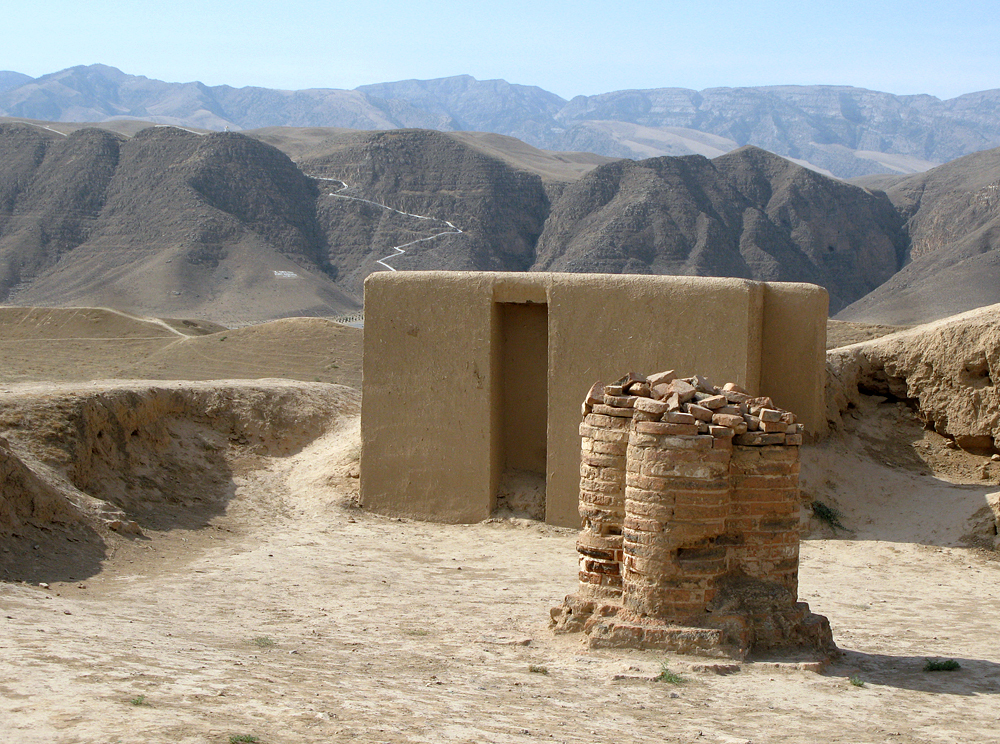
The Parthian Fortresses of Nisa, inscribed as a UNESCO World Heritage Site in 2007, offer a unique glimpse into the ancient civilization that once thrived in present-day Turkmenistan. This archaeological site, situated approximately 18 kilometers west of Ashgabat, serves as a testament to the skillful blending of indigenous cultural elements with those of the Hellenistic and Roman worlds.
More to come…UNESCO Description of the World Heritage Site
The Parthian Fortresses of Nisa consist of two tells of Old and New Nisa, indicating the site of one of the earliest and most important cities of the Parthian Empire, a major power from the mid 3rd century BC to the 3rd century AD. They conserve the unexcavated remains of an ancient civilization which skilfully combined its own traditional cultural elements with those of the Hellenistic and Roman west. Archaeological excavations in two parts of the site have revealed richly decorated architecture, illustrative of domestic, state and religious functions. Situated at the crossroads of important commercial and strategic axes, this powerful empire formed a barrier to Roman expansion while serving as an important communication and trading centre between east and west, north and south.
UNESCO Justification of the World Heritage Site
Criterion (ii): Nisa is situated at the crossroads of important commercial and strategic axes. The archaeological remains vividly illustrate the significant interaction of cultural influences from central Asia and from the Mediterranean world.
Criterion (iii): The Parthian Empire was one of the most powerful and influential civilizations of the ancient world, and a brilliant rival of Rome which prevented the expansion of the Roman Empire to the east. Nisa, the capital of the Parthian Empire, is the outstanding symbol of the significance of this imperial power.
Encyclopedia Record: Nisa, Turkmenistan
Nisa was an ancient settlement of the Parthians, located near the Bagyr neighborhood of Ashgabat, Turkmenistan, 18 km west of the city center. Nisa is described by some as the first seat of the Arsacid Empire. It is traditionally assumed to have been founded by Arsaces I and was reputedly the royal residence of the Parthian kings, although it has not been established that the fortress at Nisa was either a royal residence or a mausoleum.Additional Site Details
Area: 77.905 hectares
Number of Components: 2
(iii) — Unique or exceptional testimony to a cultural tradition
Coordinates: 37.9997222222 , 58.1986111111
World Heritage Research
Discover scientific research and academic studies that deepen our understanding of Parthian Fortresses of Nisa from its history and significance to its conservation, management, and contemporary challenges.
-
İslam Fethinden Selçuklulara Kadar Nesâ (30-426/650-1035)
Nisa, a Parthian fortress located near modern-day Ashgabat, Turkmenistan, experienced significant growth and development from its conquest by Muslims in 650 to its incorporation into the Seljuk Empire in 1035. This study reveals that Nisa's political status within Horasan, its urban structure, rural settlements, and socio-economic dynamics underwent substantial changes during this period. By integrating medieval written sources with modern archaeological and geographical data, researchers reconstructed Nisa's evolution, highlighting its transition from a regional power to a culturally and economically thriving city under Seljuk rule. The findings underscore the resilience and adaptability of Nisa's society amidst shifting political landscapes.
Özbayraktar, A. (2024). İslam Fethinden Selçuklulara Kadar Nesâ (30-426/650-1035). Selçuk Üniversitesi Selçuklu Araştırmaları Dergisi, (21), 1–26. https://doi.org/10.23897/usad.1444565
View Publication Record | Read Publication -
Sphragistics of the Parthian Periphery
A comparative analysis of seal impressions from Parthian Fortresses, including Old Nisa (Parthia's ancient capital) and neighboring sites such as Artashat (Armenia), Göbekly-depe (Margiana), and Gabala (Azerbaijan), reveals distinct regional variations in the depiction of Greek-Roman and Iranian motifs. While Armenian seals predominantly feature Hellenistic imagery, with some Iranian influences, Old Nisa shows a balanced representation of both traditions. In contrast, Göbekly-depe's seals are overwhelmingly Iranian, while Gabala exhibits a mix, suggesting local Eastern traditions with occasional Greek-Roman elements. This study highlights the cultural dynamics and regional identity in Parthian peripheral areas through sphragistics (the study of seals).
Гаибов, В. А., & Никитин, А. Б. (2023). SPHRAGISTICS OF THE PARTHIAN PERIPHERY. Hypanis. Труды Отдела Классической Археологии ИА РАН, 109–115. https://doi.org/10.25681/iaras.2020.978-5-94375-324-4.109-115
View Publication Record | Read Publication -
Seismotectonic aspects of the Ms 7.3 1948 October 5 Aşgabat (Ashgabat) earthquake, Türkmenistan: right-lateral rupture across multiple fault segments, and continuing urban hazard
A 1948 earthquake (Ms 7.3) that devastated Aşgabat, Türkmenistan, was found to have ruptured a right-lateral strike-slip fault southeast of the city and likely reactivated a concealed thrust along the Gyaursdag anticline. The study, using historical seismograms, regional seismicity data, satellite imagery, and digital elevation models, determined that the earthquake probably nucleated near Aşgabat and involved multiple fault segments, including one northwest of the city with no clear surface expression. Geomorphic evidence suggests significant strike-slip and oblique strike-slip faulting in the region, with luminescence dating indicating a vertical displacement rate of 0.6 mm/yr for fluvial terraces west of Aşgabat. The findings highlight ongoing urban seismic hazards linked to these active faults.
Marshall, N., Ou, Q., Begenjev, G., Bergman, E., Bezmenov, Y., Dodds, N., Gruetzner, C., Hudson, T., Pierce, I., Mirzin, R., Rhodes, E., Walker, R. T., & Wordsworth, P. (2023). Seismotectonic aspects of the M s 7.3 1948 October 5 Aşgabat (Ashgabat) earthquake, Türkmenistan: right-lateral rupture across multiple fault segments, and continuing urban hazard. Geophysical Journal International, 237(1), 315–338. https://doi.org/10.1093/gji/ggad488
View Publication Record | Read Publication -
The “Seal of Rodogune” from Parthian Nisa
A seal from the Parthian Fortresses of Nisa, previously thought to depict Rodogune, is revealed to likely represent Apollo, marked by a laurel wreath. This discovery challenges earlier attributions and suggests a late date for the seal, placing it between the 1st century BC and 1st century AD. The analysis, based on stylistic execution, situates this seal within a broader group of sealings from the Square House of Nisa, contributing to our understanding of Parthian iconography and chronology.
Invernizzi, A. (2022). The “Seal of Rodogune” from Parthian Nisa. Electrum, 29, 73–86. https://doi.org/10.4467/20800909el.22.006.15776
View Publication Record | Read Publication -
Концепт «восточный город»
A comprehensive analysis reveals the linguistic and cultural dimensions of the concept 'Oriental Urban Locality,' centered on Parthian Fortresses of Nisa. The study identifies key lexemes, toponyms, and micro-toponyms—such as Samarkand, Bactra, and the Bibi-Khanym mosque—that encapsulate the essence of urban life along the Great Silk Road. Through etymological analysis, semantic interpretation, and conceptual mapping, researchers uncover how language units reflect broader cultural contexts, including landscapes (deserts, oases) and architectural elements (madrasahs, caravanserais). This methodology, applicable to any concept, exposes the periphery of the 'Oriental Urban Locality' framework, offering insights into its linguocultural peculiarities. The findings bridge linguistic research with historical geography, enriching our understanding of Central Asian urban development.
Kogay, E. R. (2021). «Шығыс қаласы» концепті. Eurasian Journal of Philology Science and Education, 183(3). https://doi.org/10.26577/ejph.2021.v183.i3.ph4
View Publication Record | Read Publication -
Silver Kithara from Old Nisa
A silver artifact discovered at Old Nisa, a Parthian fortress now recognized as a UNESCO World Heritage Site, has been reattributed by researchers. Previously thought to be a ceremonial axe symbolizing martial power, the silver kithara arm and its cylindrical yoke with tuning pins suggest it was part of a larger musical instrument, likely from a bronze or silver statue. This reattribution challenges conventional interpretations and sheds new light on the cultural significance of such artifacts in Greco-Iranian contexts during the 2nd century BC. The study employs stylistic analysis to date the kithara between the 3rd and 1st centuries BC, supported by comparisons with Hellenistic pictorial evidence. Reconstruction drawings provide further insight into its design, contributing to our understanding of ancient musical instruments and their symbolic roles in antiquity.
Dedyulkin, A. (2020). Silver Kithara from Old Nisa. Vostok. Afro-Aziatskie Obshchestva: Istoriia I Sovremennost, (3), 74. https://doi.org/10.31857/s086919080009920-9
View Publication Record | Read Publication