World Heritage Identification Number: 976
World Heritage since: 2000
Category: Cultural Heritage
WHE Type: Archaeological Sites
Transboundary Heritage: No
Endangered Heritage: No
Country: 🇰🇷 Republic of Korea
Continent: Asia
UNESCO World Region: Asia and the Pacific
Map
Unraveling the Rich History of Gyeongju Historic Areas
The Gyeongju Historic Areas, nestled within the heart of Gyeongju, South Korea, serve as a testament to the flourishing of the Silla Kingdom (57 BC – 935 AD). This UNESCO World Heritage Site, designated in 2000, offers a rich tapestry of Korean cultural heritage, showcasing an exceptional collection of Buddhist-related remains, royal tombs, ancient palace sites, and sacred mountain landscapes.
The Silla Kingdom, one of the Three Kingdoms of Korea, reached its zenith between the 7th and 9th centuries. During this period, Gyeongju functioned as its capital and became a major center of politics, religion, and culture. The Gyeongju Historic Areas reflect this golden age, preserving the urban, spiritual, and funerary landscapes of a highly sophisticated early Korean state.
One of the defining characteristics of the Gyeongju Historic Areas is the integration of Buddhist heritage into the natural landscape. Rather than a single concentrated complex, the site is composed of five distinct belts scattered across the city and surrounding hills. These include temple ruins, stone Buddha carvings, pagodas, and sacred sites that together illustrate the spread and localization of Buddhism in Silla society.
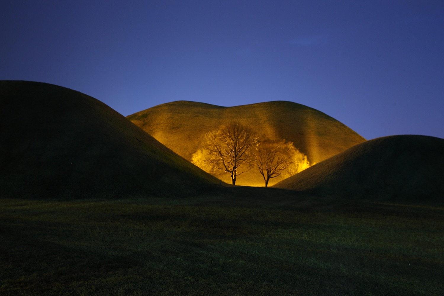
Among the most significant components is the Mount Namsan Belt, which functions as an open-air museum featuring countless stone Buddhas, relief carvings, and temple ruins embedded in the mountain landscape. The Tumuli Park Belt (including the Daereungwon Tomb Complex) contains large earthen burial mounds belonging to Silla royalty and elites, offering insight into ancient burial customs and social hierarchy. The former palace area at the Wolseong Belt, along with the nearby Donggung Palace and Wolji Pond, reflects the political and ceremonial center of the Silla capital.
Another important monument within the Wolseong Belt is Cheomseongdae, regarded as one of the oldest surviving astronomical observatories in East Asia. Built in the 7th century during the reign of Queen Seondeok, it demonstrates the advanced scientific knowledge of the Silla period and the importance of astronomy in governance and ritual practice.
The Sanseong Belt represents the defensive landscape of the surrounding hills. These elevated fortification areas, such as Myeonghwal Fortress, illustrate the military dimension of the Silla capital and its strategic use of natural terrain for protection. In combination with the palace grounds and royal tombs, they highlight how Gyeongju functioned as a fully integrated capital where political power, spiritual life, and urban planning were closely interconnected.
A key component of the Hwangnyongsa Belt is the remains of the Hwangnyongsa Temple Site, once one of the largest temple complexes in East Asia. Although now in ruins, the site reflects the Silla Kingdom’s strong state support for Buddhism and its ambition to express political authority through monumental religious architecture. Together with the nearby Bunhwangsa Temple, it provides crucial evidence of how Buddhism was integrated into the urban and ideological framework of the ancient capital.
While the Gyeongju Historic Areas encompass the heart of the ancient capital, they are perfectly complemented by a neighboring UNESCO World Heritage site designated in 1995: Seokguram Grotto and Bulguksa Temple. Located on the slopes of Mount Toham, these sites represent the pinnacle of Silla’s architectural and artistic mastery, and serve as a spiritual extension of the Gyeongju Historic Areas, completing the narrative of a kingdom that sought to create a Buddhist utopia on earth.
Altogether, the Gyeongju Historic Areas present a multilayered cultural landscape that reflects the political power, religious development, and artistic achievements of the Silla Kingdom. The combination of royal tombs, palace ruins, Buddhist relics, and scientific structures creates a rare historical continuity that allows visitors to experience the depth of early Korean civilization. The site stands as a powerful reminder of the cultural sophistication and enduring legacy of Silla heritage.
UNESCO Description of the World Heritage Site
The Gyeongju Historic Areas contain a remarkable concentration of outstanding examples of Korean Buddhist art, in the form of sculptures, reliefs, pagodas, and the remains of temples and palaces from the flowering, in particular between the 7th and 10th centuries, of this form of unique artistic expression.
UNESCO Justification of the World Heritage Site
Criterion (ii) The Gyeongju Historic Areas contain a number of sites and monuments of exceptional significance in the development of Buddhist and secular architecture in Korea. Criterion (iii) The Korean peninsula was ruled for nearly a thousand years by the Silla dynasty, and the sites and monuments in and around Gyeongju (including the holy mountain of Namsan) bear outstanding testimony to its cultural achievements.
Encyclopedia Record: Gyeongju Historic Areas
Gyeongju Historic Areas is a World Heritage Site in Gyeongju, South Korea that was designated by UNESCO in 2000. The protected areas encompass the ruins of temples and palaces, outdoor pagodas and statuary, and other cultural artifacts left by the Koreanic kingdom Silla.Additional Site Details
Area: 2,880 hectares
Number of Components: 5
(iii) — Unique or exceptional testimony to a cultural tradition
Coordinates: 35.78889 , 129.22667
Image
© Sung Soo KIM, CC BY-SA 3.0 Resized from original. (This derivative is under the same CC BY-SA license.)
